
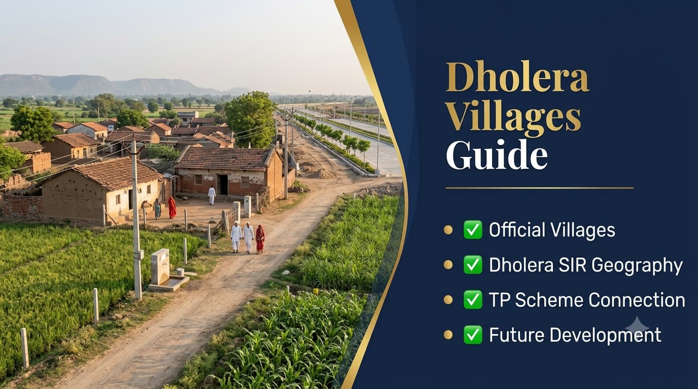
Dholera Villages
Dholera SIR is planned to be developed within a vast planned region, which covers a number of existing villages and the areas that surround them. An understanding of these villages is important for anyone looking at the geography, planning framework, land use structure, and development history of the region. The Dholera Villages Guide sheds light on how these villages, Special Investment Region, Town Planning Schemes, and the developing land areas relate to one another. This guide will help the reader differentiate the existing rural villages from those being developed as industry and housing.
The villages constitute an important geographical foundation for the development process in Dholera. Land plots, roads, agriculture lands, existing villages, and infrastructure in the surrounding areas have all become a part of a much bigger planning process of the region. However, having a village in Dholera SIR doesn’t automatically mean that all its plots have the same status in terms of land use and development. Anyone buying or investing in any type of land should first establish the name of the village, survey number, and planning designation.
| Dholera Villages Overview | Details |
| Region | Dholera Special Investment Region |
| Geographic Setting | Rural Gujarat Development Region |
| Existing Settlements | Multiple Official Villages |
| Planning Framework | Town Planning Schemes |
| Major Transformation | Rural to Planned Industrial & Urban Region |
| Key Development | Infrastructure, Industry & Urban Services |
| Land Verification | Village, Survey & Planning Status |
Villages Within Dholera SIR
The villages associated with Dholera SIR represent the existing settlements and land areas incorporated into the broader regional development framework. These villages existed before the current large-scale infrastructure programme and continue to form an important part of the area’s geographical identity. Their inclusion within the planning region allows infrastructure and land-use development to be coordinated across a much larger area rather than being limited to a single urban settlement. The Dholera villages should therefore be understood as part of the region’s original geographic structure. Agricultural land, village settlements, internal roads, water resources, and surrounding open areas contribute to the existing landscape. Planned infrastructure is being introduced within this broader setting, creating a transition between the traditional rural environment and the proposed industrial and urban development.
| Village-Related Element | Importance |
| Existing Settlements | Historical & geographic foundation |
| Agricultural Areas | Existing land-use component |
| Village Roads | Local connectivity |
| Survey Parcels | Land identification |
| TP Schemes | Planned land-use framework |
| Infrastructure | Regional development support |
A village name appearing in a property advertisement should not by itself be treated as evidence of a particular development status. The exact parcel must be checked against official planning information, land records, and applicable regulations. This is especially important because different parcels within the same village can fall under different planning or land-use conditions.
Official Villages and the Dholera Planning Framework
The planning of Dholera SIR involves more than simply developing vacant land around existing settlements. Town Planning Schemes provide a structured mechanism for organising land, roads, infrastructure, public facilities, and development areas. These planning mechanisms are important for understanding how village land becomes incorporated into the larger development framework. The relationship between villages and TP Schemes can also explain why the landscape around Dholera may look different from a conventional city. Existing agricultural and village areas can exist alongside newly planned roads, industrial infrastructure, utility corridors, and developing urban zones. This creates a gradual transition rather than an immediate replacement of the existing rural environment.
| Planning Component | Role |
| Existing Villages | Geographic foundation |
| TP Schemes | Organised land-use planning |
| Roads | Regional & local connectivity |
| Infrastructure | Supports development |
| Industrial Areas | Economic activity |
| Urban Areas | Future residential & commercial growth |
Why Dholera Villages Matter
The villages are important not only because they define the original geography of the region but also because their surrounding land has become part of a much larger development strategy. Understanding the villages helps explain where different roads, infrastructure projects, industrial zones, and planned urban areas are located. For researchers, investors, and property buyers, village-level information can provide a useful starting point for identifying a property’s exact location. However, village names should always be combined with survey details and official planning information. A general reference to a village is insufficient to establish whether a particular parcel is residential, industrial, agricultural, commercial, or subject to another planning designation.
| Why Village Information Matters | Practical Use |
| Geographic Identification | Locates a property or development |
| Land Research | Helps trace survey parcels |
| Planning Research | Connects land with TP Schemes |
| Infrastructure Study | Identifies surrounding development |
| Property Verification | Supports due diligence |
This is particularly relevant to people searching for Dholera village map, village locations, or land opportunities in Dholera. Maps and online listings can provide useful orientation, but official records should be used when making legal or financial decisions.
Rural Landscape and Planned Development
One of the distinctive characteristics of Dholera is the coexistence of traditional rural surroundings with large-scale planned infrastructure. Agricultural fields, village roads, houses, and local community areas remain part of the landscape, while new roads, utility networks, industrial infrastructure, and other development projects are being introduced across the region. This transition is important when understanding the development story of Dholera. It is not simply a new city constructed on an empty site; instead, the wider development framework incorporates an existing geographic and settlement structure. The resulting landscape combines older rural elements with newer planned infrastructure.
| Existing Rural Element | Planned Development Element |
| Agricultural Fields | Industrial & Urban Zones |
| Village Roads | Planned Road Network |
| Traditional Settlements | New Urban Development |
| Local Infrastructure | Modern Utility Systems |
| Rural Land Use | Structured TP Planning |
For property buyers, this makes location research especially important. A parcel may be surrounded by agricultural land today while being located within a broader planned development area. Conversely, a location marketed as part of Dholera’s future growth may still require significant infrastructure development before it becomes suitable for the buyer’s intended use.
Villages, Infrastructure and Future Development
Infrastructure development is gradually changing the relationship between existing villages and the wider Dholera region. Roads and utility networks improve accessibility, while industrial and urban projects create new economic activity around the established settlements. The Ahmedabad–Dholera Expressway and other regional connectivity projects also strengthen the relationship between Dholera and major centres such as Ahmedabad. The impact of infrastructure, however, should be evaluated at the individual location level. Not every village or parcel will experience identical development conditions at the same time. Buyers should therefore verify the current status of roads, utilities, TP Schemes, surrounding projects, and land-use permissions before drawing conclusions about a particular location.
| Development Factor | Village-Level Relevance |
| Road Infrastructure | Improves accessibility |
| Utility Networks | Supports future development |
| Industrial Projects | Creates economic activity |
| TP Schemes | Defines planned land use |
| Regional Connectivity | Links villages with major centres |
| Urban Development | Changes surrounding land use |
Sapient Realty can use village-level location analysis as part of a broader Dholera property evaluation, but buyers should independently verify land records, ownership, planning status, and applicable permissions before proceeding with any transaction.
Dholera Villages and Property Research
Village-level research is particularly important for buyers looking at land within the Dholera development region because the same village can contain parcels with different ownership records, land-use classifications, planning conditions, and development potential. A village name alone does not establish whether a particular parcel can be used for residential, commercial, industrial, or agricultural purposes. Buyers should therefore identify the exact survey number and examine the applicable planning and revenue records. This approach is more reliable than depending solely on property advertisements or general location descriptions. The distinction between the village location and the planned development zone is also important. Some areas may have stronger infrastructure and accessibility, while others may remain predominantly rural or agricultural. Understanding this difference helps buyers assess the current condition of a location instead of basing a decision entirely on its projected future development.
| Property Research Point | What to Verify |
| Village Name | Exact geographical location |
| Survey Number | Specific land parcel |
| Ownership | Current legal ownership |
| Land Use | Permitted use |
| TP Scheme | Applicable planning framework |
| Road Access | Existing physical connectivity |
| Infrastructure | Current development status |
Dholera Villages and Town Planning Schemes
Town Planning Schemes are an important part of understanding how land within the Dholera region is being organised for future development. They provide a framework for roads, infrastructure, public facilities, development parcels, and different land-use requirements. Consequently, a village that forms part of the wider planning area should not be evaluated only according to its existing rural appearance. The relationship between Dholera villages and TP planning also explains why infrastructure may appear alongside agricultural fields and traditional settlements. Planned roads and utility corridors can gradually change accessibility and surrounding land use, while existing village areas continue to retain their geographical and social importance.
| TP Planning Element | Purpose |
| Roads | Improve planned connectivity |
| Development Parcels | Organise future land use |
| Public Facilities | Support planned communities |
| Utilities | Provide infrastructure |
| Open Spaces | Support planned urban structure |
Anyone researching land should therefore establish the relevant TP Scheme before making assumptions about future development. The Dholera Master Plan Guide provides additional context on the relationship between master planning and Town Planning Schemes.
Connectivity of Dholera Villages
Connectivity is another important factor when evaluating village locations. Existing village roads provide local access, while regional roads and larger transportation projects connect the Dholera area with Ahmedabad and other economic centres. The Ahmedabad–Dholera Expressway is particularly relevant to the wider regional connectivity framework, although individual villages may require additional local-road travel to reach the main corridor. This means that statements such as “near the expressway” or “near Dholera SIR” should be checked against the exact location. A property may be geographically close to an important infrastructure project but still have a different practical travel route depending on local roads and access points.
| Connectivity Level | Example |
| Local | Village and internal roads |
| Regional | Major connecting roads |
| Expressway | Ahmedabad–Dholera corridor |
| Industrial | Roads serving development zones |
| Future Network | Planned transportation infrastructure |
Why Buyers Should Verify Village Land
Buying land in a developing region requires careful verification because future development expectations can sometimes become mixed with current legal or planning conditions. A property being located within the broader Dholera SIR does not automatically mean that it has the same development rights as every other parcel in the region. Buyers should verify title, land records, land use, planning status, access, and applicable approvals before committing funds. Sapient Realty can assist buyers in comparing locations and understanding property-related information, but legal verification should be completed through qualified professionals and official records. This is especially important when a property is being promoted primarily on the basis of future infrastructure or expected appreciation.
Understanding the Future of Dholera Villages
The future development of Dholera is likely to create a gradual transition between existing villages and planned industrial and urban areas. New infrastructure can improve accessibility, while industrial and commercial activity may increase demand for supporting services and workforce facilities. At the same time, the existing villages remain an important part of the region’s geographical foundation. The most useful way to understand this transformation is to consider the region as an interconnected planning system rather than treating individual villages as isolated property markets. Infrastructure, industrial development, transportation, utilities, and urban planning collectively influence how different locations evolve.
| Development Component | Connection with Villages |
| Industrial Growth | Creates regional economic activity |
| Road Development | Improves accessibility |
| Utility Expansion | Supports planned development |
| Urban Planning | Changes surrounding land use |
| Commercial Growth | Adds supporting services |
For investors and researchers, village-level information therefore provides valuable geographical context, but it should always be combined with parcel-specific verification. This is particularly important when evaluating land in Dholera, plotted developments, or properties marketed around future infrastructure.
Frequently Asked Questions
How many villages are included in Dholera SIR?
Dholera SIR covers a group of existing villages within its planned regional boundary. The exact list and planning status should be checked against current official Dholera SIR and planning authority records because village-level planning information can change as development progresses.
Why are Dholera villages important?
The villages form the geographical and historical foundation of the Dholera development region. Their surrounding agricultural land, roads, settlements, and infrastructure have become part of the wider planning framework for industrial and urban development.
Are all Dholera villages part of the smart city?
Not necessarily in the sense that every village parcel becomes an urban development plot. Dholera Plots is a large regional planning area containing different land uses and development zones. The exact status of a parcel should be verified through applicable planning and land records.
Can I buy land in Dholera villages?
Land transactions may be possible depending on the specific parcel, ownership, land-use classification, planning restrictions, and applicable regulations. Buyers should verify the exact survey number, title, permitted use, and relevant approvals before proceeding.
Are Dholera villages included in TP Schemes?
Some village areas are associated with the Town Planning Scheme framework used for Dholera Smart City organizing land and infrastructure within Dholera SIR. The applicable TP Scheme should be verified for the specific parcel rather than assuming that the entire village has identical planning conditions.
Are Dholera villages connected to the expressway?
The wider Dholera region benefits from major road connectivity, including the Ahmedabad–Dholera corridor. However, individual villages may require local roads to connect with the main transportation network, so actual accessibility should be checked for each location.
Are the villages still rural areas?
Existing rural characteristics remain visible in parts of the region, including agricultural fields, traditional settlements, and village roads. At the same time, planned infrastructure and industrial development are changing the surrounding landscape progressively.
Can village location affect land value in Dholera?
Location can influence land value through factors such as road access, infrastructure, planning status, surrounding development, and permitted land use. A village name alone should not be treated as a reliable indicator of a property’s market value.
What should I verify before buying Dholera village land?
Buyers should check ownership, title documents, survey details, land-use classification, applicable TP Scheme, road access, infrastructure status, and relevant permissions. Independent legal verification is advisable before completing a transaction.
Can Sapient Realty help with Dholera village property research?
Sapient Realty can assist prospective buyers with location comparisons and property-related information. However, buyers should independently verify legal ownership, planning status, land records, and applicable permissions before making a purchase.
Conclusion
The villages of Dholera have great importance geographically speaking, as the villages represent the geographical base upon which the area will be transformed into an industrial/urban development area. There are still villages, farmlands, village roads, and village infrastructure present amidst roads being laid out, utilities being set up, industrial development, and planning development areas. This makes Dholera stand out from the rest of the newly constructed cities since development is happening on an existing rural base.
What can be learned by both the buyers and investors is the fact that a village name can only serve as a starting point for further research and not as a proof that a property can develop and appreciate in value. Important factors such as survey number, land use classification, planning, ownership, road infrastructure, and availability of infrastructure should be considered and investigated before making any financial decisions. Future infrastructure may affect accessibility and development of the area but not all individual parcels within the area. Sapient Realty can include village-level information on Dholera properties’ analysis especially when comparing various properties and development within the area.


