
DDA L Zone Delhi
The DDA L Zone Delhi is a significant planning zone in the western and south-western part of the city, which is quite important for the research on land-pooling and future urban development. The zone must be described not only by its locality name but by its planning boundaries, land-use plan, sectors, villages and development scheme. As for the research on property, recognition of the correct zone is an important point since information about the land-use pattern, infrastructure, sector plans and other aspects of development could be found in the planning data of the particular zone.
What Is DDA L Zone?
Delhi L Zone is one of Delhi’s planning zones, which is a part of urban-extension planning system of the city. This zone includes both already developed land and undeveloped one as well as agricultural and open lands, infrastructure corridors and areas of planned urban development.
DDA L Zone at a Glance
| Planning Aspect | Information |
| Zone | L |
| Delhi Master Plan 2047 | Delhi Development Authority planning framework |
| Broad Location | Western / South-Western Delhi |
| Land-Pooling Relevance | Important |
| Planning Resources | Zonal Plan, Revenue Map, Sector Delineation Plan and pooled-land maps |
| Development Character | Existing settlements combined with planned urban-extension areas |
| Property Research Focus | Zone, village, sector, land use, land-pooling status and planning documents |
DDA L Zone Map
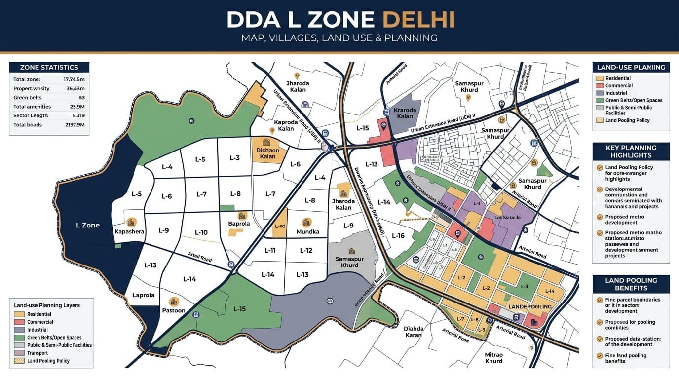
The DDA L Zone Map should not just be seen as a location map but rather as a planning map which sets up the context in relation to how the zone boundary relates to the villages, sectors, roads, adjacent planning zones, and other features on the map. The best way to conduct research when looking at properties is by starting off with locating the property first, figuring out the planning zone of the property, and then proceeding to look at the zone maps.
What to Look for on the L Zone Map
- L Zone boundary
- Adjacent planning zones
- Village boundaries
- Sector boundaries
- Major roads and transportation corridors
- Existing settlements
- Agricultural and open areas
- Planned development areas
- Land-pooling sectors
- Revenue-map references
- Sector delineation
- Pooled-land information
Delhi L Zone Planning Resources
| Resource | Purpose |
| L Zone Zonal Plan | Provides zone-level planning information |
| L Zone Revenue Map | Helps relate planning information to revenue boundaries |
| Sector Delineation Plan | Shows the division of the planning area into sectors |
| Sector-Wise Pooled-Land Maps | Helps examine mapped pooled land within individual sectors |
| Land-Pooling Area Map | Provides wider context for land-pooling areas |
| Land-Use Map | Helps understand designated land-use patterns |
DDA L Zone Villages
Village names are important when researching land within L Zone because a planning zone can contain different revenue villages and parts of villages may interact with adjoining planning areas. Therefore, a village name by itself should not be treated as proof that an entire village falls within one planning zone or one development framework.
Villages and Areas Associated With L Zone Planning
| Village / Area | Research Consideration |
| Mundaka | Parts may relate to different planning-zone contexts |
| Bakkarwala | Relevant to land-pooling and planning research |
| Dhoolsiras | Relevant to planning and land-pooling context |
| Ghewra | Requires zone-specific verification |
| Goela Khurd | Relevant to land-pooling research |
| Masoodabad | Requires location-level verification |
| Nangli Sakrawat | Relevant to planning and land-pooling research |
| Tajpur Khurd | Relevant to planning and land-pooling context |
Delhi L Zone Land Use
| Land-Use Factor | Why It Matters |
| Designated land use | Shows the planned function of the area |
| Existing physical use | Helps understand the current situation |
| Surrounding land use | Provides wider development context |
| Road network | Helps understand connectivity and planned movement |
| Public facilities | Indicates nearby institutional infrastructure |
| Open spaces | Helps identify recreational and green areas |
| Utility infrastructure | Relevant to development planning |
| Agricultural areas | Important when examining undeveloped land |
| Sector planning | Adds detail beyond broad zone-level information |
L Zone and Land Pooling
L Zone has a special significance when it comes to the DDA land pooling scheme of Delhi. Land pooling studies in L Zone are not limited to the determination of whether a village is connected to the scheme or not. The sector, pooled land, land use, planning documents, and property documents need to be studied. DDA’s planning documents are sources of sector-related information in L Zone.
What to Check in a Land-Pooling Property
- Planning zone
- Village
- Sector
- Exact parcel location
- Land-use designation
- Pooled-land status
- Revenue boundaries
- Sector delineation
- Surrounding development
- Road and infrastructure planning
- Ownership and title documents
- Applicable development requirements
L Zone Sectors
| Research Level | What to Examine |
| Zone | Confirm that the property falls within L Zone |
| Village | Identify the relevant revenue village |
| Sector | Determine the applicable planning sector |
| Parcel | Locate the specific land or property |
| Land Use | Check the designated planning use |
| Pooled Land | Check whether the parcel appears in relevant pooled-land information |
| Infrastructure | Review roads and planned infrastructure |
| Documents | Verify title, ownership and applicable records |
DDA L Zone and Real Estate
L Zone should be considered for real-estate investigation using various planning factors other than just assuming its future development. The fact that this zone is associated with land pooling makes it important in terms of relevance to the landowners and investors, but one has to note that there may be differences regarding the location of each individual property depending on the village, sector, land use, and land pooling among others.
Why L Zone Information Matters
- Helps identify the broader planning environment
- Provides context for land-pooling research
- Helps locate relevant sectors
- Shows surrounding planned uses
- Helps understand infrastructure planning
- Supports more detailed property research
- Helps distinguish zone-level information from parcel-level information
- Provides a framework for reviewing development documents
How to Research a Property in DDA L Zone
- Identify the exact property location
Start with the actual land parcel or property location rather than only the locality name. - Confirm the planning zone
Establish whether the property falls within L Zone. - Identify the village
Determine the relevant revenue village and check whether the location crosses or relates to another planning context. - Identify the sector
Locate the applicable sector using the relevant planning material. - Check land use
Examine the designated land-use category for the property and surrounding area. - Check land-pooling status
Determine whether the specific parcel is included in relevant pooled-land information. - Review infrastructure
Examine roads, transportation connections, utilities and other planned infrastructure. - Verify property records
Review ownership, title and other property-specific documentation separately.
L Zone Property Research Priorities
| Priority | Information to Establish |
| Location | Exact property position |
| Zone | L Zone confirmation |
| Village | Relevant revenue village |
| Sector | Applicable planning sector |
| Land Use | Designated land-use category |
| Land Pooling | Whether relevant pooled-land mapping applies |
| Development | Existing and planned surrounding development |
| Infrastructure | Roads and other planned facilities |
| Legal Records | Ownership and title verification |
Common Mistakes in Research
- Assuming every property in a village has the same planning status
- Treating the entire L Zone as one uniform development area
- Checking only the locality name
- Ignoring sector boundaries
- Confusing existing land use with planned land use
- Assuming land-pooling inclusion means immediate development permission
- Relying on old maps without checking current planning information
- Ignoring revenue records
- Treating broad planning information as property-specific approval
- Making investment conclusions without verifying the individual parcel
FAQs
What is DDA L Zone Delhi?
DDA L Zone is a designated planning zone in Delhi that includes existing settlements and areas associated with planned urban development. It is also relevant to research related to Delhi’s land-pooling framework.
Why is DDA L Zone important for property research?
L Zone is important because its planning framework includes zone-level plans, sector information and land-pooling-related resources. These can help users understand the planning context of a specific property or land parcel.
Does the entire L Zone have the same land use?
No. Different parts of the zone can have different planning designations and development characteristics. The exact location, sector and applicable planning documents should be checked.
Is every property in an L Zone village part of land pooling?
Not necessarily. Village-level identification alone is not sufficient to establish the status of an individual parcel. The relevant sector and mapped pooled-land information should also be examined.
Why is the L Zone sector important?
Sector identification provides a more detailed planning reference within the larger zone. It can help connect a property with sector-level planning and pooled-land information.
Can I identify a property only by its village name?
A village name is useful for initial identification, but it may not be sufficient for property verification. Exact location, revenue boundaries, sector information and parcel-level records should also be checked.
Does land pooling mean immediate development?
No. Land-pooling status does not by itself establish immediate development permission. Applicable planning conditions, infrastructure, land use and property-specific requirements also need to be examined.
Can existing development differ from the L Zone planning designation?
Yes. Physical development visible at a location and its planning designation can differ. Both the current situation and applicable planning documents should therefore be reviewed.
What should I check before buying land in L Zone?
Check the exact location, village, sector, land use, land-pooling status, surrounding development, infrastructure planning, ownership and title documents, and other applicable property records.
Is L Zone suitable for real-estate investment?
A broad zone label alone is not sufficient to determine the suitability of an individual property. Any assessment should be based on the specific parcel, planning status, land use, development framework, legal records and other relevant property information.
Conclusion
DDA L Zone is a vital area of planning significance for studying land use, sectors, villages, and the wider urban extension of Delhi. The significance of land pooling in DDA Zone L makes detailed planning study essential for any analysis of land/property in the area. Rather than focusing on the name of the village and the zoning boundary, the property research must proceed from location to planning zone to sector to land use to land pooling to property documentation.


